n the early
1800s an anonymous Tolland correspondent answered a query from the
Connecticut Academy of Arts and Sciences for historical background
about the town with the apologetic statement that there "are no
natural or artificial Curiosities, worth noticing." It is true that
Tolland's past claims no Indian battles, devastating
conflagrations, or famous patriot sons. Instead, the town has
slumbered through the better part of two centuries while its
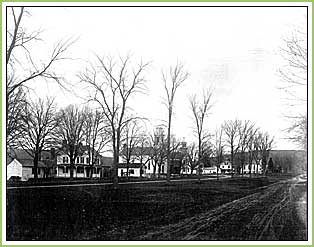
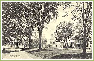
centerpiece the long, narrow (40-foot-wide) town green has itself
become a curiosity: an historic town landscape so sidestepped by
modern development that it appears to be frozen in the late
nineteenth century.
The Tolland Green is part of a tract of common
land laid out around 1722, when the original settlement relocated
to the north in order to accommodate a newly established border for
Coventry to the south. Creating a distinctive linear north-south
axis through town, the green evolved in the center of the broad
thoroughfare (present-day Route 195) that led south to the old
Boston Post Road. The old Tolland stage road (Route 74) runs from
east to west, cutting through the common near its
center.


|
|
|